
| Intro 1998 1999 | Page 1 - 2 - 3 |
1999 SEASON REPORT
By Edwin L. Barnhart
|
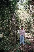
This report covers the results of the 1999 survey of Palenque's western region, an area stretching from the Motiepa River to the structures around the Picota River.
Map 1 - Overview Color version (100k file) Zoom of color version (325k file) Black and white version (50k file) Zoom of black and white version (160k file) Compared to the 107 structures recorded to the west of the Motiepa River on M.G. Robertson's map (1983), a total of 528 structures are presented for the first time in this report. The majority of Palenque's western settlement was built upon a flat, east-west running plateau, the same plateau utilized by the structures of Palenque's central precinct. Further settlement extends above and below the plateau, built upon platforms and massive terraces protruding from the hillsides. The areas around the Motiepa, Piedras Bolas and Picota Rivers are densely covered with small residential structures. All three rivers contain evidence of water management architecture.
Furthest west, around the Picota River, the constructions are larger and appear to be public spaces. Features including the Olvidado Temple, two temples directly to the west of the Olvidado, the Picota Complex (plaza, aqueduct and stela), and the newly documented Escondido Platform combine to create the impression that a second "center" existed at Palenque. This newly recognized "center" and the residential areas between it and Palenque's primary center will be discussed in the sections that follow.
In keeping with the designation system begun by Blom in the 1920's, areas of Palenque's western region have been divided into groups. A map outlining the group boundaries defined by the PMP appears in Map 2.
Map 2 - Group Boundaries Color version (112k file) Zoom of color version (355k file) Black and white version (54k file) Zoom of black and white version (172k file) The process of establishing group boundaries was made difficult by the extremely dense settlement pattern encountered. As a general rule, rivers and arroyos were used as group boundaries. Some boundaries were established along monumental terrace faces. In a few cases (i.e. Group J West and the Piedras Bolas Group) modern trails and roads were used as boundaries. While not an ideal system of sub-division, the groupings presented in this report were considered the best solution to the issue of previous publication compatibility.
The next sections will discuss the western groups individually and the following questions will be addressed for each. What kind of topography was the group built upon? How many structures, courtyards and terraces were documented? Is there surface evidence of water management? Where is the exposed architecture located? Have any structures been looted? Features and structures of special character will be discussed individually.
Map 3 - Group J West & Motiepa East
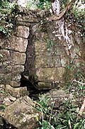
Group J West was clearly part of Group J but has now been physically separated from it by the road to the ruins parking lot. The road cuts off two large structures, JO12 and JO26, and four east-west running terraces. The group sits upon land sloping gently down to the north. There are a total of forty-three structures, ten courtyards and seven terraces in Group J West. Exposed architecture exists within structures JO7, 12, 20, 22, 26, and 33. No looting evidence was found. The southernmost terrace (connected to structures JO1-4) is part of a series of interconnected terraces running almost 300m from the site center all the way to the Motiepa River. Only two structures, JO26 and JO28, are strongly suspected as being non-residential in function. Their form and size are more suggestive of the lineage ancestor worship shrines commonly found in association with residential courtyard groups. There are two locations of water management evidence in Group J West. The first is an arroyo originating next to JO35, suggesting construction around a seasonally active spring. The second is the arroyo at the group's southern end which drops off a terrace, passes through architecture without destroying it and which seems to feed a diversion pool inside the elbow of an "L" shaped terrace extension.
Structure JO12, now cut by the modern road, seems to have once been connected to structure J1, the Group IV residence of Chac Zutz', the Y-ajaw K'ak' of one of Palenque's last kings, K'inich Ahkal Mo' Nahb.
Map 3 - Group J West & Motiepa East
The Motiepa East Group is situated on two natural plateaus stepping down to the north above the Motiepa's eastern bank. Many of its structures have an unobstructed view of the Motiepa cascades. The group is quite small, only twelve structures arranged around two irregularly shaped patios. No constructed terracing was detected. The architecture is small and low-lying, assumably all residential. No exposed architecture was found and only one looter's pit, in ME1. While no clear water management evidence was found, the three arroyos that join within the group seem to have been redirected. Artificial leveling done during the construction of the close-by modern road may have affected the course of the easternmost of those arroyos, further confusing the surface evidence. To the south of the Motiepa East Group, situated on top of a large limestone outcrop, sits a ruined modern structure. A staircase carved into the outcrop's face quite near the path provides access to the structure. Through discussions with long time Palenque resident Moises Morales it was learned that a German woman named Herta had once owned the structure. Herta lived in Palenque during the 1950's and used the structure as a restaurant and bar. It is now little more than a cement platform and some crumbing red brick walls. |
|