
|
|
 |
With the exception of the first map (which is presented for historical interest) all maps were prepared by the Mapping Project of Proyecto Grupo de Las Cruces, Palenque, and sponsored by the generous support of FAMSI. Historical Map - a portion of the map that appeared in The Sculpture of Palenque, Volume 1 by Merle Greene Robertson. Overview - color map (100k file) Overview - zoom of color map (325k file)
Print version of complete overview map Overview - black and white map (50k file) Overview - zoom of black and white map (160k file) Boundaries - color map of structural group boundaries (112k file). Text description from the Mapping Project Report. Boundaries - zoom of color map of structural group boundaries (355k file). Boundaries - black and white map of structural group boundaries (54k file). Boundaries - zoom of black and white map of structural group boundaries (172k file).
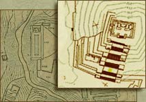
Map 1 - The Central Area. This is an overview, in smaller scale, of the following eight maps. Text description from the Mapping Project Report. Zoom view. Map 2 - The Cross Group. The Temple of the Cross and associated structures. Text description from the Mapping Project Report. Zoom view. Map 3 - Central Palenque. The North Group, The Palace, The Temple of the Inscriptions and associated structures. Text description from the Mapping Project Report. Zoom view. Map 4 - South Central Palenque. The Temple of the Jaguar, the Blue Wood Group and the Schele Terraces. Text description from the Mapping Project Report. Zoom view. Map 5 - Encantado Group. Text description from the Mapping Project Report. Zoom view. Map 6 - Group A. Text description from the Mapping Project Report. Zoom view. Map 7 - Group E. Text description from the Mapping Project Report. Zoom view. Map 8 - Group H. Text description for Group H from the Mapping Project Report. (Text description for Encantado South, which is shown on the same map.) Zoom view. Map 9 - Group J. Text description for Group J from the Mapping Project Report. (Text description for Galindo and Tik'in Ha Group, which is shown on the same map.).Zoom view.
Group J West & Motiepa East. Text description from the Mapping Project Report. Zoom view. Color version (86k). Zoom of color version (252k). The Motiepa Group & Group G. Text description from the Mapping Project Report. Zoom view. Color version (82k). Zoom of color version (235k). Moises' Retreat. Text description from the Mapping Project Report. Zoom view. Color version (86k). Zoom of color version (247k). Xinil Pa' Group. Text description from the Mapping Project Report. Zoom view. Color version (104k). Zoom of color version (308k). Piedras Bolas Group and the Olvidado. Text description of Piedras Bolas Group from the Mapping Project Report. Text description of Olvidado Group. Zoom view. Color version (86k). Zoom of color version (247k). The Picota Group. Text description from the Mapping Project Report. Zoom view. Color version (82k). Zoom of color version (235k). The Lemon Group and the Nauyaka Group. Text description of Lemon Group from the Mapping Project Report. Text description of Nauyaka Group. Zoom view. Color version (72k). Zoom of color version (207k). The Escondido Group. Text description from the Mapping Project Report. Zoom view. Color version (72k). Zoom of color version (233k). |